ezpickins

Blue Liner Flows Review | USGS Stream Gauges

  • 275
  • 2
IMG_3629.jpeg
Traveling more than an hour to go fly fishing often requires some planning. Weather and water levels are the two most important variables to understand before heading out. Everyone has their favorite weather apps, but this year more than ever, having a good understanding of water levels has been non-negotiable.

All water level data originates from the United States Geological Survey (USGS) Surface-Water Data, which monitors over 13,000 stream gauges across the U.S. and more than 350 in Pennsylvania. The USGS has been transitioning to a new online interface over the past five-plus years. The updated look and feel have left some old features behind while adding new ones. I hate it.

So, I’ve been on the hunt for a desktop and mobile app that delivers USGS backend data through a clean, easy-to-use interface. Blue Liner Flows offers a solid solution for iPhone, iPad and Mac users, with apps built for both platforms. Most importantly, favorites and preferences sync across devices. There’s a free version, but I’ll be reviewing the $6.99 annual paid version.

Key features include: favorites, state selection, map view, latest data overview, discharge in CFS, discharge in feet, average annual discharge, various time views, weather forecasts, alerts, temperatures (station-dependent), turbidity (station-dependent), and other data specific to each gauge.

I found the app very easy to set up on my Mac. Once configured, all my favorites and alerts synced automatically to my iPhone. You don’t need both devices—an iPhone alone works just fine. I especially liked navigating between the state, favorites, and map views. It’s fast and intuitive. Most views display the key information I’m looking for, including directional arrows indicating whether water levels are rising or falling.


[ATTACH type="full" width="720px"...​

Colorado Grayling

  • 1,655
  • 12
joe-wright.jpg


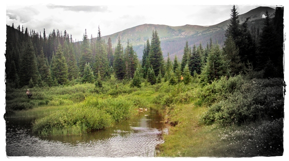
If you find yourself in the Cache la Poudre canyon area and you want to do something a little different, check out Joe Wright Creek and Joe Wright Reservoir for some grayling fishing. This past August I was fortunate enough to be in the area and I did just that. It was actually a big surprise. My fishing buddy and I had hiked into a back country lake to do some fishing for native Greenback Cuts (the bite was not on). I didn’t see a single fish, my friend managed one nice specimen though. However the trip yielded some fruit when another fisherman asked whether we had tried Joe Wright Creek and Joe Wright Reservoir for grayling yet. Well, we hadn’t. Needless to say we hiked it on down to Joe Wright Creek and, jackpot.

grayling1.jpg


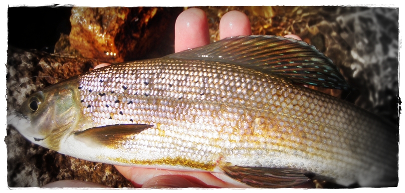
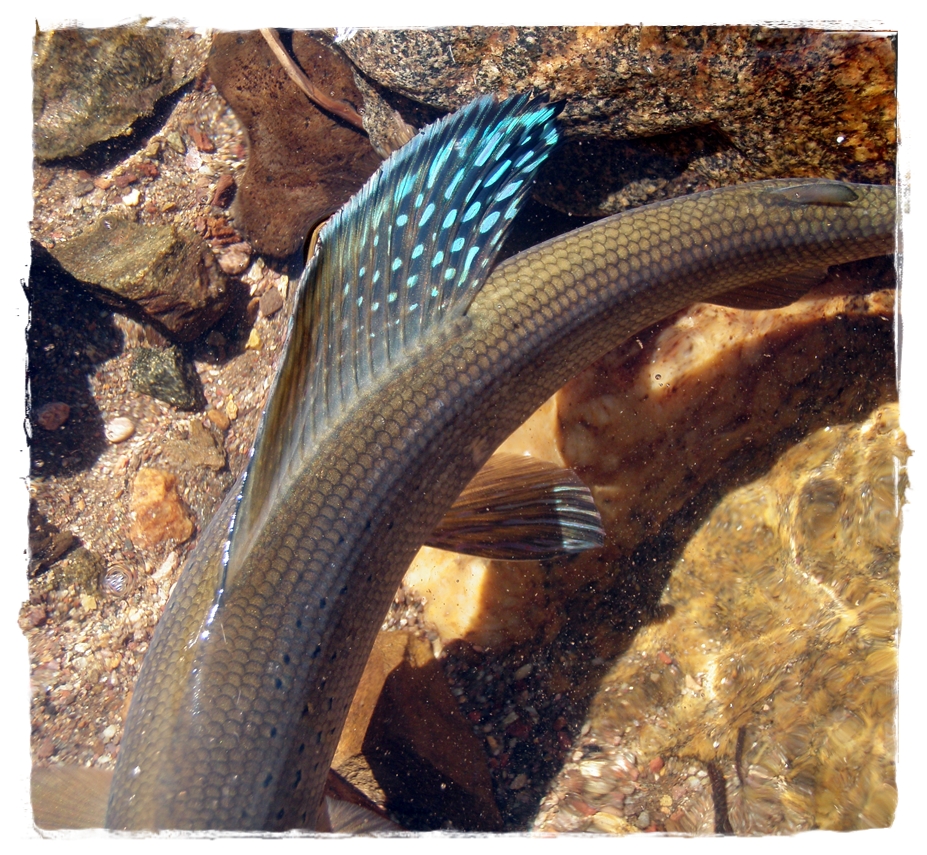
It was some fast and furious fishing. The grayling in the small stream rose to dries readily and you could pretty much expect a hit from every fish that you cast over. It was a lot of fun – and the novelty of catching grayling (which I had never done before) made it all that much more fun. We worked our way downstream to the reservoir and hooked up with some more fish at the inlet. There was even an occasional cut thrown in for good measure.

grayling11.jpg


Joe Wright Creek flows into and out of Joe Wright Reservoir which is about 33 miles east of Walden, Colorado on CO-14. The stretch of the creek where we caught grayling is above the reservoir and it’s not very long. I wouldn’t go out of my way for the grayling, but if you’re in the area to fish the Poudre. It makes a nice little diversion.

I want to thank Ezpickins for his post. He has been a member on Paflyfish for many years. He writes on CastingAround, a blog about Fly Fishing, Fly Tying and various...
Back
Top